Page 3 of 7

Re: Coastal route & farmlands to Agulhas

Posted: Sun Jun 04, 2017 6:21 pm
by Pumbaa
Fantastic bird and landscape shots, All-Nature,

for sure the blue cranes and the black shouldered kite are amazing sightings \O Love also the snail :ty:

Re: Coastal route & farmlands to Agulhas

Posted: Mon Jun 05, 2017 6:40 am
by All-Nature
Lisbeth wrote:Beautiful blue cranes and my favourite small raptor O/\ O/\
One year we stayed at Struis Bay for a week so Agulhas is well known :yes:
We will be staying at Noordhoek from Jan. 10th to Feb. 7th Maybe we can organize a mini meet?
Hope you had less wind that what we did -O-
A mini meet sounds O:V \O

Re: Coastal route & farmlands to Agulhas

Posted: Mon Jun 05, 2017 6:46 am
by All-Nature
Richprins wrote:Very interesting, AN!
I like the one-legged kite! lol

Ja, that place is windy...never going there again... :no:

My camera asks "are you sure" when deleting pics! :twisted:
Now why am I not surprised you also had wind, the wind blew from when we arrived until we left lol
My camera too... BUT I missed the ALL notification! O/ =O:

Re: Coastal route & farmlands to Agulhas

Posted: Mon Jun 05, 2017 6:51 am
by All-Nature
Pumbaa wrote:Fantastic bird and landscape shots, All-Nature,
for sure the blue cranes and the black shouldered kite are amazing sightings \O Love also the snail :ty:
Blue Cranes are beautiful and so glad to see that the breeding on some farms, they are doing well \O

Re: Coastal route & farmlands to Agulhas

Posted: Mon Jun 05, 2017 6:57 am
by All-Nature
Front view or is this the back view? -O-
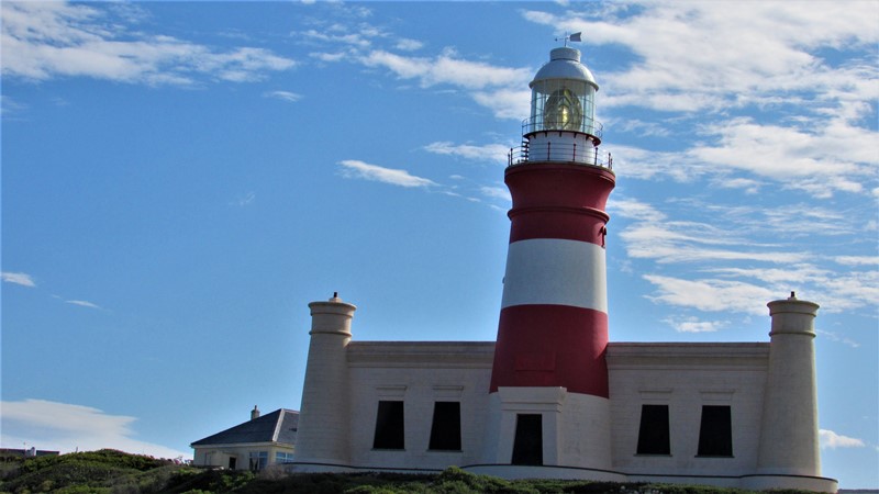
Lighthouse at Cape Agulhas, was built on the 1 March 1849.
In 1962, the sandstone from which the lighthouse was built started crumbling and a new aluminium lighthouse was erected nearby.
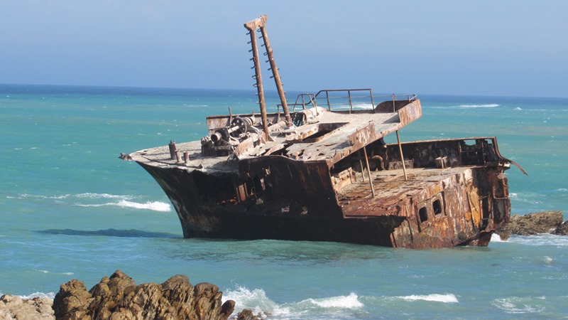
Image


Shipwrecks
Over the past few hundred years it has been believed that around 150 ships have sunk around Agulhas.
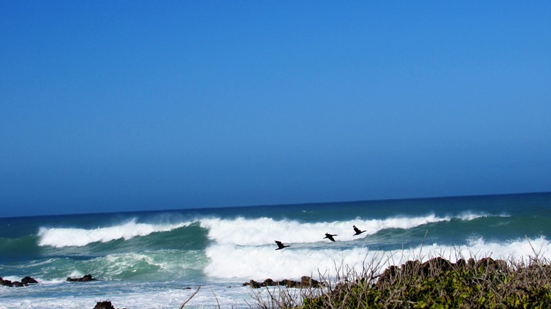
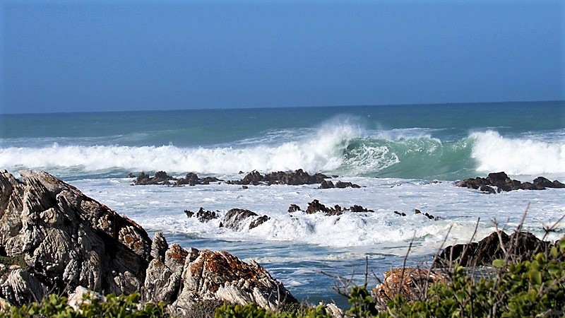
These conditions are caused by a number of factors. The naturally strong winds of the roaring forties, which blow from west to east, and the cold Antarctic Circumpolar Current flowing in the same direction, come up against the warmer Agulhas Current in the region of the Cape. These conflicting currents of water of different densities and the west winds blowing against the Agulhas Current, can create extremely hazardous wave conditions, these are further exacerbated by the shallow waters of the Agulhas Bank, a broad, shallow part of the continental shelf which juts 250 kilometres (155 mi) south from the Cape, after which it falls steeply away to the abyssal plain.

Image

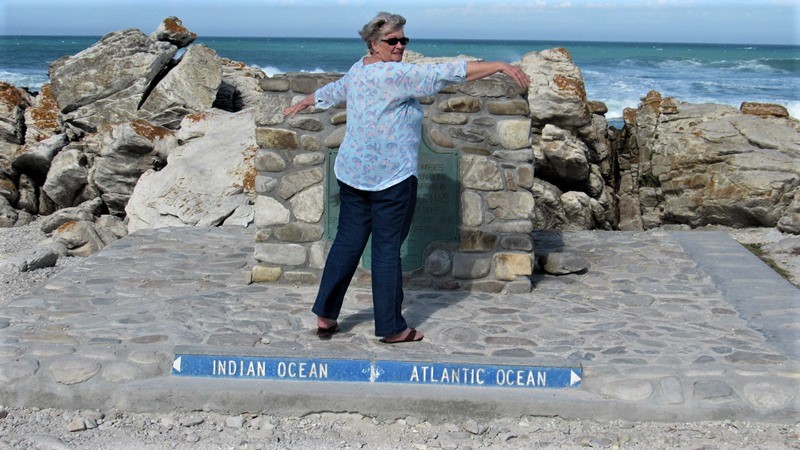
Point were the two oceans meet
The rocks that form Cape Agulhas belong to the Table Mountain Group, often loosely termed the Table Mountain sandstone. They are closely linked to the geological formations that are exposed in the spectacular cliffs of Table Mountain, Cape Point and the Cape of Good Hope.

Image

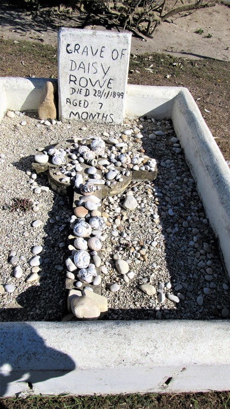
Daisy Rowe, daughter of the Light keeper stationed at L’ Agulhas between 1899 and 1901, died on December 28 1899 as a result of diphtheria. She was only seven months old and was buried in the present parking area of the Lighthouse. During the construction of the parking area the grave was lifted. The original stone cross was found broken under the soil and was reattached on top of the gravestone.
History lesson over, let’s get back to some pix’s ;-)

Image

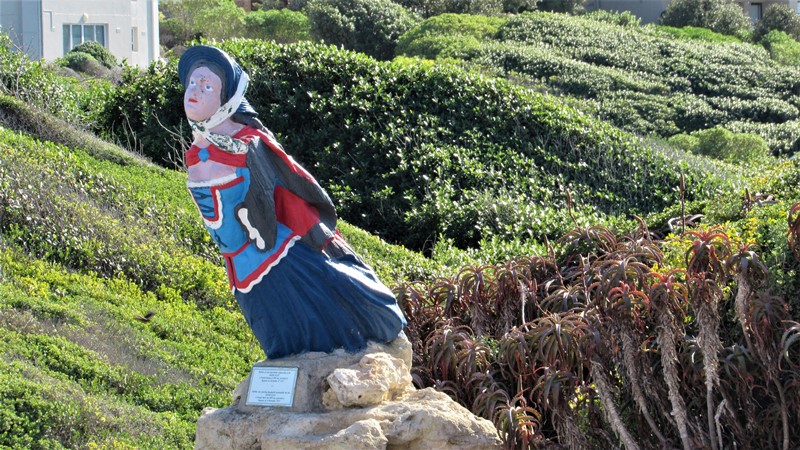
This lady once adorned one of the ships on her sea fairing journeys

Image

With the howling wind it did make for some spectacular seas

Image

Image

Re: Coastal route & farmlands to Agulhas

Posted: Mon Jun 05, 2017 7:04 am
by All-Nature
We found a shop that made the BEST fish and chips we have ever eaten O/\ Enjoyed it at the harbor, rounding it off with decadent chocolate ice cream yum :yes:
Some boats in the harbor and the sea spray a dead give away as to the speed of the wind! O**

Image

Sea views
Image

Lone Oyster Catcher

Image

Wind still blowing gales

Image

Kelp (Southern Blackbacked) Gull

Image

Cape Francolin

Image

There is a legend around this Spook which is painted on rocks, was too O-/ to find out about it =O:

Image

Took a drive up to the lookout point, view going up

Image

Re: Coastal route & farmlands to Agulhas

Posted: Mon Jun 05, 2017 7:29 am
by okie
Good going A-N \O

Re: Coastal route & farmlands to Agulhas

Posted: Mon Jun 05, 2017 8:37 am
by Mel
That certainly looks completely unrushed and very relaxing :-) I love the sea and I'll book a trip to the waters rather than going into the mountains.
The vegetation in coastal areas is much prettier than in alpine regions, mefinds lol

Re: Coastal route & farmlands to Agulhas

Posted: Mon Jun 05, 2017 9:38 am
by Lisbeth
I love the sea and must go at least once a year, but the mountains give you a kind of peace of mind that you do not find anywhere else. The quiet and the way the landscape changes every time you turn a corner and the view of the thousands of different flowers makes it unique- and then of course there are the cows lol lol Unfortunately my back does not allow me to do trekking any more :-(

All-Nature you have managed to get some spectacular shots of the sea. I love the boat full of cormorants. There was not that much wind when we were there -O-

Re: Coastal route & farmlands to Agulhas

Posted: Mon Jun 05, 2017 12:03 pm
by Bushcraft
Gansbaai looks beautiful O:V

Delete button on your camera :shock: I would have had a long lip O-/

Agulhas national park O/\ I would have ducked the lighthouse steps also =O:

Plenty wind, but good fish and chips O/\ O/\