Page 1 of 28
Pictures of the 2012 Floods
Posted: Fri May 25, 2012 10:04 am
by Flutterby
Crocodile Bridge Gate
Dec 2010 vs Jan 2012 (Courtesy of DuQues )


All thos pics we thought were the LS low level bridge were actually Croc Bridge!
Re: Pictures of the 2012 Floods
Posted: Fri May 25, 2012 10:04 am
by Flutterby
Crocodile River at Malelane Gate

Crocodile River (Courtesy of TonyW )

Re: Pictures of the 2012 Floods
Posted: Fri May 25, 2012 10:05 am
by Flutterby
Deck at Lower Sabie (Courtesy of Twitter)

High level bridge between Skukuza and Tshokwane

Re: Pictures of the 2012 Floods
Posted: Fri May 25, 2012 10:05 am
by Flutterby
Olifants High Level bridge (Courtesy of section ranger, posted by serval)

The H1-4 between Satara and Olifants (Posted by Shutterbug)

Re: Pictures of the 2012 Floods
Posted: Fri May 25, 2012 10:06 am
by Flutterby
Letaba Camp

Napi Road from Pretoriuskop just before Transport Dam

Skukuza Golf Course

Re: Pictures of the 2012 Floods
Posted: Fri May 25, 2012 10:06 am
by Flutterby
Sabie River

Lower Sabie low level bridge

Re: Pictures of the 2012 Floods
Posted: Fri May 25, 2012 10:07 am
by Flutterby
Hoedspruit (Pics Courtesy of News24)


Re: Pictures of the 2012 Floods
Posted: Fri May 25, 2012 10:07 am
by Flutterby
Blyderiver Dam at 118% capacity (Courtesy of News24)

Re: Pictures of the 2012 Floods
Posted: Fri May 25, 2012 10:08 am
by Bushcraft
ecojunkie wrote:Photos taken late yesterday afternoon at Lower Sabie
From Keartland guest house looking north - where I am standing was under water the previous evening!

Taken looking along the fence - the line in the grass indicates the water level (approx half-way across grass)

Damage in the safari tents


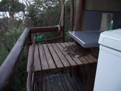
Showing how high the water reached there - debris on the table

Debris on the fence

And finally the bridge shortly before 9am this morning

Re: Pictures of the 2012 Floods
Posted: Fri May 25, 2012 10:08 am
by Richprins


