Mining in or Close to Protected Areas

Information and Discussions on Mining Issues
User avatar
Lisbeth
Site Admin
Posts: 66797
Joined: Sat May 19, 2012 12:31 pm
Country: Switzerland
Location: Lugano
Contact:

Re: Mining in or Close to Protected Areas

Post by Lisbeth »

Canadian firm ReconAfrica’s quest for Namibian oil and gas poses seismic risk to elephant behaviour

By Annette Hübschle and Sophie Rathmell• 3 June 2021
Image
The environmental impact assessment reports for ReconAfrica’s planned 2D seismic surveying failed to consider the impact of seismi...

Canadian oil and gas company ReconAfrica has submitted an application for an environmental clearance certificate to Namibia’s environmental commissioner to conduct 2D seismic surveys in the northeastern Kavango regions. Complementary to exploratory drilling, seismic surveys help locate oil and gas reservoirs. While the environmental impact assessment reports fall short on many fronts, we pick up on a particularly crucial issue which we believe is not dealt with in the assessment in a competent manner: the impact of seismic surveying on elephant behaviour.

Annette Hübschle is a senior research fellow with the Global Risk Governance Programme at the University of Cape Town. Her research focuses on new harmscapes of the Anthropocene, resilience to climate change and trafficking flows. Originally from Namibia, Annette is a founding member of the NGO Frack Free Namibia.

Sophie Rathmell is currently pursuing a Master’s degree at the University of Cape Town in Environment Society & Sustainability. Her research has a concentration in environmental and social justice. Originally from the United States, she has enjoyed immersing herself in the context-specific environmental issues that are present in southern Africa.


Our objection is coupled with a plea to employ the precautionary principle to protect the largest cross-border elephant herd from the harmful actions linked not only to seismic surveying but also from the ongoing exploratory oil and gas drilling in Namibia.

The world found out about the planned oil and gas explorations in the biodiverse Kavango East and West regions of Namibia in an article published in Daily Maverick in mid-September 2020. Environmental activists, local communities, NGOs and even members of the public were not privy to an environmental impact assessment (EIA) process that had been completed and signed off in 2019.

The company had sailed through the EIA process for the drilling of exploratory boreholes on communal and conservation lands with little or no community engagement and also no critical list of Interested and Affected Parties in contravention of Namibia’s Environmental Management Act 7 of 2007.

Normally in Namibia a high-impact industrial development that would affect a rural area would include in it’s EIA the voices of local and indigenous communities, experts, scientists as well as local, regional and international organisations who are working in the region. There was so little engagement that no objections or concerns were raised or published in the final EIA that led to the Environmental Clearance Certificate for drilling to be issued.

When the story broke in September 2020 about a small and relatively unknown Canadian gas and oil company by the name of Reconnaissance Energy Africa (ReconAfrica) it was already courting investors with promises of riches from a supposed massive unconventional (read fracking) oil and gas development in Namibia and Botswana. At that point the company was getting ready to ship an oil rig to Namibia’s port of Walvis Bay and into this unique biodiverse ecosystem that is part of the Okavango River system. Not only is this region home to about 200,000 people, but a diversity of endemic and endangered plant and animal species survive here. This includes the last free-ranging cross-border elephant herd of about 130,000 pachyderms.

The company had not only secured exploration rights in Namibia but also in neighbouring Botswana, a contiguous exploration area of close to 35,000km2. While Namibians and allies from around the world were scrambling to get details and information of what was planned, ReconAfrica and its Namibian subcontractors were preparing drill sites. The oil rig and other equipment arrived in early December 2020 and drilling started on the first stratigraphic borehole near the village of Kawe in the crop field of a local farmer on 21 December 2020.

CNN reports that residents found the increasing noise levels and traffic distressing. Meanwhile, the company rolled out a second environmental impact assessment process to undertake 2D seismic surveys – a complementary method to map out how big a prospective oil and gas reserve could be. This time interested and affected parties registered in large numbers.

Most of the registered feedback published with the Seismic EIA outlined serious concerns with the environmental and social impacts of the seismic survey and the drilling, as well as water safety and impacts on water wells in this arid region where water (not oil) is gold.

The exploratory drilling and seismic surveying are taking place about 40km south of the Okavango River and upstream from the Okavango Delta and Tsodilo Hills, which are both listed as Unesco World Heritage sites. The World Heritage Site at Tsodilo was excluded from explorations by the Botswana government after an intervention by Unesco.

The exploration area also stretches across parts of the San Cultural Landscape on Unesco’s tentative list, with the ancestral lands of the San First Nations indigenous groups directly affected. Another point of contention is that one of the biggest protected areas in the world, the Kavango-Zambezi Transfrontier Conservation Area (Kaza), and six community conservancies and 15 community forests overlap with ReconAfrica’s oil-prospecting area.

One of the key objectives of Kaza is to create cross-border wildlife corridors connected to national parks and reserves to enable seasonal migration of elephants and other wildlife species. Botswana has the world’s largest cross-border population of about 130,000 savanna elephants and Namibia is home to around 24,000 individuals.

The environmental impact assessment reports for ReconAfrica’s planned 2D seismic surveying failed to consider the impact of seismic surveys on savanna elephants in a scientific manner based on previous research. It is for this reason that we prepared a scientific review based on peer-reviewed literature and interviews with elephant experts to inform the general public and lodge an objection with Namibia’s Environmental Commissioner, Timoteus Mufeti.

Our objection to the seismic survey is coupled with a plea to employ the precautionary principle when considering undertaking seismic surveying and oil and gas explorations in elephant migration corridors. The precautionary principle should be used in two circumstances: either to avoid severe or irreversible environmental damage, or when it is unclear whether an activity will have a severe or permanent effect. In the case of savanna elephants, which were added to the International Union for the Conservation of Nature (IUCN) Red List in April 2021, it is vital to employ the precautionary principle to protect savanna elephants from the harmful actions linked not only to seismic surveying but also from the ongoing exploratory oil and gas drilling for both reasons.
Image
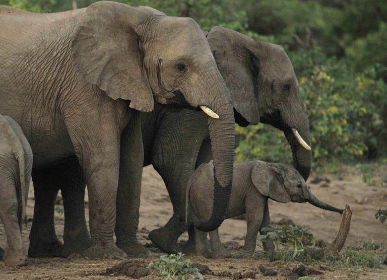
Elephants in Botswana. (Photo: Supplied)

The precautionary principle

Seismic surveying, both 2D and 3D, takes place by laying receptors called geophones along either a line (2D) or in a grid (3D) and detonating an explosive device or using something similar like a hydraulic ram, then recording the various soundwaves that are picked up by the geophones. The data collected from the geophones tells researchers the likely composition of the earth below the surface and can help companies decide where to pursue extraction for oil and gas, whether there is any recoverable resource and potentially the size of the deposit.

Elephants also use seismic activity, but in an entirely different way. Caitlin O’Connor-Rodwell and team have studied how elephants and great mammals use seismic waves as a communication channel for more than two decades. They found that elephants use fatty tissue on their feet and extremely advanced cochlea to send seismic signals to one another. These signals travel below the surface of the Earth, between 10Hz and 40Hz, and can send important messages concerning food, location of other herds, breeding and nearby predators. Using seismic signalling, elephants communicate within their own and geographically distant herds, often across large distances, helping each other to survive by sending different kinds of messages between each other.

Elephants are genetically designed to receive these messages as effectively as possible. However, these survival tools are steadily being encroached upon by human activity. For example, a study by Mortimer and colleagues on savanna elephant behaviour in Kenya suggests that elephants use the seismic component of rumbles for long-range communication. Seismic communication could also be used to send a sign of distress or aggression. Rapid running in elephants, for example, might signal the presence of poachers to other herds. The researchers suggest that anti-poaching units could use the detection of rapid running to curb elephant poaching. However human-made noise including car sounds and, by extension, much more powerful seismic surveying is possibly limiting the effectiveness of this important form of communication.

Seismic surveying usually takes place within the range (10Hz to 40Hz) that elephants use, which causes disruption along their lines of communication. In response to this and the presence of humans in their habitats to conduct the surveys, savanna elephants are forced to change their behaviour. Research led by Rabanal looked into oil prospecting and its impacts on large rainforest mammals, including forest elephants, in Gabon’s Loango National Park. The researchers found that large mammals, especially those who use seismic activity to communicate, face a huge risk when extractive industries enter their rangelands.
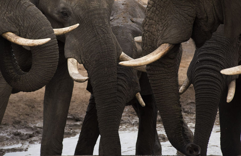
Image
Elephants use seismic activity to communicate. (Photo: Supplied)

Rumbles in the jungle

The study reveals that elephants avoided the areas where seismic surveys are taking place for close to half a year after the testing has been conducted, and they shifted their daily activities to follow a nocturnal schedule in order to avoid the daytime seismic operations.

Research by Plumptre and colleagues for the Wildlife Conservation Society in Uganda’s Murchison Falls National Park between 2013 and 2015 found that elephants avoided seismic activities for up to 8km, and that elephants and several other wildlife species stayed away from active drill pads for up to 1km. The avoidance of these areas by multiple species caused wildlife to encroach on each other’s territories, disrupting normal living, feeding and breeding patterns.

Displacement can also force elephants into harm’s way and may put them at greater risk of being poached. Pearson and Dawson warn that ignoring human-made factors when looking at wildlife populations may lead to incorrect assessments of habitat requirements that affect their survival and/or persistence in rangelands. In other words, elephant habitat studies should consider the influence of human activities on elephant behaviour.

MacKenzie and colleagues conducted focus groups with directly affected communities and tourist operators near Murchison Falls National Park in 2017. Their findings suggest that the elephants’ behavioural change to nocturnal activities coupled with displacement led to more crop raiding, which in turn has negatively affected the livelihoods of local communities and encroached upon the feeding grounds of other wildlife.

Similar findings of habitual change in elephants were recorded in Loango National Park in 2010 by another study undertaken by Wrege and colleagues. The researchers also detected secondary impacts such as reduced foraging time, more competition for high-quality food resources and increased stress levels.

Managing elephants in a landscape where local people and elephants coexist poses a major challenge in countries like Namibia where elephant populations are stable or increasing because protected land often competes with different land uses.

The Kavango regions have a long history of human-elephant conflict. In March 2021, Namibia’s Minister of Environment, Forestry and Tourism, Pohamba Shifeta, said elephants were “wreaking havoc to crops, water infrastructure and property” in nine of Namibia’s 14 regions including Kavango East and West. The ministry is mapping wildlife corridors to minimise human-wildlife conflict.

A growing body of research is looking into using “landscapes of fear” to reduce human-wildlife conflict by using animals’ instinctive desire to avoid risk. Gail Thomson describes an animal’s landscape of fear as being based on their life experiences and lessons from their parents or others in their social groups teaching them which parts of their environment or times of day are more or less risky. Because of the lack of an elephant habitat study in ReconAfrica’s EIA, it is impossible to know how the current drilling campaign by the company is affecting elephant activity, but the chairperson of the Kavango East and West Regional Conservancy and Community Forestry Association, Max Muyemburuko, reports that residents have already documented anecdotal accounts of changing elephant behaviour, with elephants moving closer to homesteads and crop fields since exploratory drilling began. Increased incidents of crop raiding have also been recorded.
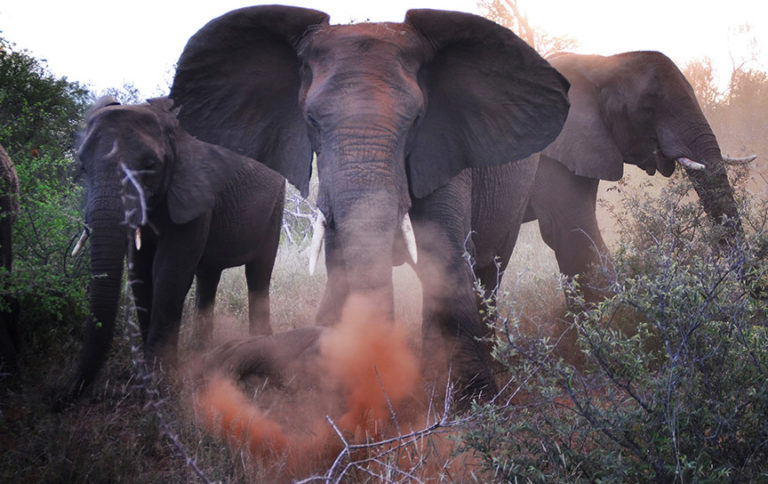
Image
Elephants at the Makalali Private Game Lodge. (Photo: Supplied)

In the absence of an elephant specialist or habitat study it is not surprising that the environmental assessment practitioner, Dr Sindila Mwiya, and ReconAfrica CEO Scott Evans would claim that there were no elephants within the area of seismic testing and near the drill sites. In public meetings attended by Namibian journalist John Grobler, Mwiya also claimed that the seismic testing by way of slamming a hydraulic hammer into an aluminium dome to generate shockwaves of 300Hz into the ground would not impact elephants as they vocalise at lower frequencies.

In addition, Mwiya claimed that ReconAfrica’s daytime surveying away from “elephant activities” would not interfere with their behaviour. Without the input of elephant experts on the impacts of the Explorer 860 seismic surveying system (which touts itself as “better than dynamite”) and an elephant habitat study, the environmental assessment practitioner lacks the competence to make the ruling that there would be not “any frequency specific interference with the natural receiving environment”.

Existing literature suggests that elephants are extremely noise sensitive and it would not be surprising if they were sensitive to sounds around 300Hz. Elephants run from the sound of disturbed bees and aggressive tiger and leopard growls, and male Asian elephants disperse when vocalisations of wild Asian elephant matriarchal groups are played back.

In conclusion, existing research shows that seismic surveying has affected elephant behaviour negatively and the long-term impacts are yet to be fully assessed in numerous African countries. Oil drilling and extraction causes irreparable environmental damage by extracting fossil fuels from the earth, as well as encroaching on endangered species’ habitat.

Second, and similarly, because savanna elephants are specially protected species in Namibia and the continental savanna elephant population has been reclassified as endangered by the International Union for the Conservation of Nature, human activity should not be allowed when there is uncertainty, in the absence of research, about the scope and severity of the impact of seismic exploration on elephant behaviour, health, level and retention of fear, societal bonds, communication and elephant interactions with rural people. Full studies should be done before any more drilling or land-clearance activities are undertaken by the company. At the very least a comprehensive and independent monitoring programme should be established whereby potential changes in behaviour and movements of a representative fraction of the elephant populations in Khaudum National Park and Nyae Nyae Conservancy can be recorded in response to seismic exploration.

Third, the research uncovered here is substantial enough to make the argument that at the very least it is harmful to the delicate environment that elephants and local communities find themselves in, and that until absolutely proven to not harm savanna elephants, the seismic activity should be prevented. The precautionary principle suggests that action should be taken to avoid harming one of the world’s most iconic endangered species that is already facing multiple threats to its long-term survival.

The encroachment of elephant habitats by ReconAfrica ignores and disrupts one of the key aspects of elephant survival, and places increased risk on their already fragile ecosystem which in turn can have long-term negative effects on their population longevity and on the livelihoods of the surrounding farming communities. Due to the lack of clear environmental studies that lay the groundwork for elephant populations and movement in ReconAfrica’s licence area, the authors believe the Namibian government should immediately suspend the companies’ Environmental Clearance Certificate for drilling and not allow the company to begin any seismic surveying until such a time as the company satisfies the environmental requirements for these industrial activities in such an ecologically important region. DM

The authors would like to thank Jeff Barbee for editing the piece and Max Muyemburuko for supplying information.


"Education is the most powerful weapon which you can use to change the world." Nelson Mandela
The desire for equality must never exceed the demands of knowledge
User avatar
Lisbeth
Site Admin
Posts: 66797
Joined: Sat May 19, 2012 12:31 pm
Country: Switzerland
Location: Lugano
Contact:

Re: Mining in or Close to Protected Areas

Post by Lisbeth »

KZN’s marine treasures: Sasol Offshore oil drilling sustains a major legal broadside

By Kevin Bloom• 24 June 2021

Image
Illustrative image | Sources: Unsplash / TI Fitzsimmons | Unsplash / Chris Leboutillier | EPA/PAUL BUCK | Unsplash / Sebastian Pena

In August 2019, the South African oil giant Sasol and the Italian behemoth Eni were granted environmental authorisation to drill for hydrocarbons in the middle of seven ‘marine protected areas’. The ensuing uproar delivered no fewer than 47 appeals, which were all knocked back by the national government. But in mid-June 2021, papers were filed in the North Gauteng High Court that represent the strongest challenge yet. The question remains: will the madness stop?

To hear it from divers that are familiar with the seasons and rhythms of the Protea Banks, there are waters off the KZN coast that are like nowhere else on earth. They will tell you of huge schools of hammerheads that glide overhead in summer; hundreds of ragged-tooths that flash past in winter; elusive tiger sharks that can be spotted from January to June; perennial bull sharks and oceanic blacktips; aggregations of giant guitar sharks that are endemic to this 1,200 square kilometres of sea.

You may also hear stories of eagle rays, round ribbontail rays and sometimes even mantas. From the game fishermen, you may be regaled with tales of the ones that got away; from kingfish, sailfish and marlin to barracuda, dorado and wahoo.

The marine biologists will speak in great detail about the reefs and submarine canyons, where there are species of corals and comb jellies that are still unknown to science. And the locals, if you ask them, might tell you about the humpback whales, which breach and fluke and spy-hop on their way to the south pole.

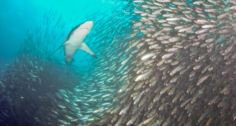
Still, the best stories are reserved for the months of May and June, when tens of millions of sardines run north up the east coast, after spawning on the Agulhas Bank where the two oceans meet.

Image
(Photo: Flickr / wildestanimal)

In the Government Gazette of 23 May 2019, in recognition of this ecological wonder, the former minister of environmental affairs, Nomvula Mokonyane, declared the Protea Banks a marine protected area (MPA). The declaration dealt with scientific search permits, general restrictions on the use of vessels, prohibitions in the no-go zone, scuba diving regulations and the total ban on fishing for the area’s sharks and rays. The full regulations would take effect, stated the minister, on 1 August 2019.

Less than four weeks later, on 26 August 2019, the Department of Mineral Resources and Energy gave the go-ahead to Sasol and Eni to drill for hydrocarbons — the principal components of petroleum and natural gas — off this very same stretch of coast.

Despite 47 appeals against the environmental authorisation, the South African government has until now favoured the oil giants. But on 15 June 2021, in a founding affidavit that ran to more than 600 paragraphs, the South Durban Community Environmental Alliance (SDCEA) delivered to the North Gauteng High Court the strongest challenge yet.

The Protea Banks featured heavily in the papers, as did another six MPAs — according to the commissioned experts, they would all be at “risk of significant impact” if the oil giants prevailed.

“Four of these MPAs,” noted marine scientist Jean Harris in her report, “are close enough to the proposed drilling sites… to make them vulnerable to persistent degradation and damage from day-to-day operational pollution, oil leakages and smaller spills that are documented to occur, in addition to them being at significant risk should a major oil spill incident happen.”

Aside from Protea Banks, Harris was referring in the above assessment to uThukela, Aliwal Shoal and Pondoland, which — like the remaining MPAs — had been designated according to the provisions of the National Environmental Management: Protected Areas Act (NEM:PA).

Harris also noted that the designation of all seven vulnerable MPAs had been supported by the National Environmental Management: Integrated Coastal Management Act (NEM:ICMA), which “intends to ensure that coastal and marine environments are afforded a high degree of protection in the interests of the whole community and for the benefit of future generations”.

As an expert witness, it was doubtful that the SDCEA’s attorneys could have done much better than Harris. Not only could she boast 25 years in the field, but for 11 of those years, she had led the scientific services team of Ezemvelo KZN Wildlife, the chief governmental oversight authority for the MPAs on the province’s coast.

Ezemvelo KZN Wildlife, it turned out, had been named as the ninth respondent in the case.

***

“The applicant now institutes this application seeking to have both the initial decision and the appeal decision reviewed and set aside,” we read on page 3 of the founding affidavit, with respect to the environmental authorisation.

On page 32, after a summary of the relevant legislation, we arrive at the first ground for review.

As alleged, the South African Agency for the Promotion of Petroleum Exploration and Exploitation, commonly known as PASA, had been acting way beyond its scope. PASA, the papers state, had not only “performed the role of the competent authority” in accepting the application for an environmental authorisation, it had actually accepted and approved the all-important final scoping report.

Quoting from the correspondence, the affidavit refers to a letter that PASA had written to Environmental Resources Management (ERM), the environmental assessment practitioner that had been hired by Sasol and Eni to prepare the relevant reports:

“[PASA] has evaluated the submitted [final scoping report]… and is satisfied that the documents comply with the minimum requirements… The FSR is hereby accepted in terms of Regulation 22(a) of the EIA Regulations, 2014. You may therefore proceed with the environmental impact assessment…”

Needless to say, if the judge were to agree with the interpretation of the SDCEA’s attorneys, this would be the ultimate case of the fox running the henhouse.

The applicant further alleges in the papers that ERM missed its deadline for submission of the draft EIA, failed to formally apply for an extension (as required by the regulations) and yet received an automatic extension from PASA anyway.

The second ground for review concerns “procedural unfairness in the EIA process”, where the applicant maintains that PASA was somehow unsatisfied with the original oil spill modelling report and so commissioned an independent audit, which it then failed to share with the “interested and affected parties”. As a “controversial aspect” of the final environmental authorisation, the SDCEA alleges, anything to do with the modelling of oil spills should have been fully disclosed.

Then, in the third ground for review, we get to the “material errors of law”, which primarily concern three environmental management acts that were either “inadequately considered” or not taken into account at all. Here, the SDCEA takes direct aim at the minister and deputy-director general of the DMRE — the acknowledged competent authorities — by contending that “an oil spill on land is very different to an oil spill in coastal waters with currents, wave and tidal movements”.

The acts in question, aside from NEM:PA and NEM:ICMA, include the National Environmental Management: Biodiversity Act (NEM:BA). Each of these key pieces of legislation, as the applicant points out, fall within the framework of the National Environmental Management Act, which in turn articulates section 24 of the South African Constitution.

Since the initial authorisation and the rejection of the subsequent appeal were both primarily based on the distances between the drilling coordinates and the protected areas — distances that run anywhere from 20 kilometres to 50 kilometres — the SDCEA alleges that the minister and DDG “had no more than passing regard to the overriding legislative importance” of these acts. But, as the SDCEA makes clear with respect to the reports of its own experts, “coastal processes and habitats are inherently dynamic and inter-related and the legislative focus is on protecting such ecosystems as a whole”.

Here, the influence of the Agulhas current is paramount. Throughout the affidavit, expert opinion is provided on the high speeds of the current, its “inshore tidal movements” and the fact that “sharks, rays, seabirds and turtles” use it as a transport highway.

“In summary,” the affidavit states, quoting directly from Harris’ report, “the drilling of these six oil wells is not in the interests either of the people living along the coast in question (both rural and urban communities), those who rely on the ocean for their livelihoods or of the ‘other living organisms’ that live in the ocean where the drilling is to occur, nor those that live in the coastal inshore areas in the path of the Agulhas current downstream of the drilling sites.

“For both the coastal people and the other living organisms, the prospect of this activity brings only risk and no benefit.”

***

None of this, however, was accounting for the global context, where climate and ecosystem collapse were beginning to wreak the sort of havoc that placed offshore oil drilling in an entirely new realm of “alleged” human stupidity.

In his assessment of the marine ecologists report (MER) and oil spill report (OSR) that Sasol and Eni were required to submit as part of the authorisation process, Simon Elwen — a marine biologist with over 20 years’ experience and 50 peer reviewed papers to his name — noted that the documents had focused “almost exclusively on the impacts of the short-term and localised exploration drilling phase”. As a result, added Elwen, the ministerial and appeal decisions were presumably made on that basis too.

As the founding director and principal scientist at Sea Search, a research company that offers specialist advice on marine conservation and environmental impact assessments, Elwen was perfectly placed to point out the obvious — the exploration phase, if hydrocarbons were indeed found, would be no more than a precursor to the “exploitation” phase.

“The impacts of long-term hydrocarbon extraction will be substantially broader in spatial scale,” he noted, adding that the duration of the project would then run into decades.

“Additionally, hydrocarbon extraction here will lay the foundation for further expansion of fossil fuel infrastructure in both marine (e.g. rigs, tankers) and terrestrial ecosystems (e.g. refineries).

“A strategic assessment and broad and long-term perspective of the environmental impacts of hydrocarbon extraction within the framework of global sustainability goals and climate change impacts should have been considered during decision-making but was not included in the Final EIA Report.”

Further, Elwen observed, neither the MER nor the OSR took into account the “likely concentration” of shipping routes that the exploitation phase would entail, which in turn would have “implications for all forms of pollution from noise to spills, especially in relation to existing protected areas”.

And if that wasn’t enough, there appeared to be something even more potentially destructive that the OSR had overlooked, mainly because it had based the probability of an oil spill on what Elwen and other experts had termed “highly averaged data” on weather conditions.

“In this industry,” Elwen observed, “most accidents happen during extreme weather events, which often have very atypical wind or swell characteristics (e.g. different directions and much greater power). Given the predicted increases in both the power and frequency of extreme weather events, and likelihood of an accident taking place under unusual weather conditions, the OSR has likely significantly underestimated the scale of an oil spill event.”

All of the above is included in the SDCEA’s founding affidavit, of course, under the fourth ground for review — “inadequate consideration of need and desirability”.

While Elwen’s report falls under the sub-header of “failure to consider negative impacts”, the overview of the section makes for equally incriminating reading. The final EIA, notes the applicant, does not take into account climate change considerations, nor does it consider alternatives, “including the no development option”.

In the first instance, as per the expert report of climate scientists Mark New and Shayan Barmand, the “emissions of CO2 from burning proven oil reserves” will “substantially exceed” South Africa’s carbon budget, as defined by the Paris Agreement. In the second instance, the possibility of not going ahead with the project isn’t even up for debate.

The fifth ground for review digs deeper into the tenets of NEM:ICMA, where the DMRE’s “failure to consider the whole community of life, including humans”, is the core accusation. As an aside, the section also notes that the final EIA does not list the track records of either Sasol or Eni in complying with previous environmental authorisations, pointing out the oil spills and attendant allegations of corruption that had been levelled against the latter “in several countries including Nigeria, Iraq, Kazakhstan, Algeria and Congo”.

The sixth ground for review, “failure to give adequate consideration to international law”, is where most of this comes together. The list of global laws, treaties and conventions that the environmental authorisation allegedly breaches is long and distinguished, particularly in light of the fact that South Africa is a signatory to all of them.

From the Convention on Migratory Species, which South Africa became a party to in 1991, to the Convention on Biological Diversity, which the country ratified in 1993, the affidavit is in this section a tribute to humanity’s best intentions.

But neither of these conventions, nor the World Heritage Convention (signed 1997), Ramsar Convention (signed 1975) and International Whaling Convention (signed 1948), appear to have been given much thought by the competent authority, which says something about our collective road to hell.

And while the seventh and final ground for review takes in “other relevant considerations”, it appears no less damning. Here, included among a list of seven allegations, are the “inadequacy of oil spill modelling”, the “absence of an oil spill contingency plan” and the “failure to assess intangible ocean heritage”.

Perhaps unsurprisingly, given the length and seriousness of these allegations, the SDCEA’s attorneys have informed Daily Maverick that they expect the respondents’ answering affidavits by no earlier than mid-September. Perhaps equally unsurprisingly, the respondents Daily Maverick approached for comment chose not to reply.

Either way, PASA, two national departments, two provincial agencies and two giant oil companies have a massive fight on their hands. In terms of relief, all the applicant asks is for the madness to stop. DM/OBP


"Education is the most powerful weapon which you can use to change the world." Nelson Mandela
The desire for equality must never exceed the demands of knowledge
User avatar
Lisbeth
Site Admin
Posts: 66797
Joined: Sat May 19, 2012 12:31 pm
Country: Switzerland
Location: Lugano
Contact:

Re: Mining in or Close to Protected Areas

Post by Lisbeth »

Oil-drilling threat to Africa’s oldest national park highlighted by young activists’ documentary

By Lungi Langa• 2 July 2021

Image

Young activists from Democratic Republic of the Congo have created a documentary speaking out against the threats posed to Africa’s oldest proclaimed national park and one of the continent’s premier World Heritage Sites, Virunga.


Young activists have spoken out against the effects of fossil fuel exploration in Virunga National Park, a biodiverse site that is one of the most treasured parks in Democratic Republic of the Congo (DRC).

The activists launched their documentary on Thursday to coincide with the country’s celebrations of 61 years of independence. The documentary is part of an ongoing campaign to speak out against oil exploration in the park.

The park, which is a Unesco World Heritage Site, was proclaimed in 1925 and is home to at least a third of the world’s wild mountain gorillas and an astonishing variety of birds and other animals, according to its website.

The activists have shared their frustrations and concerns about the harm that is being inflicted on the animal and plant life in the area. Although the 10-minute documentary produced by environmental organisation 350 Africa in collaboration with the activists is in French, the subtitles ensure that no one misses out on the information being shared.

Among the many concerns shared by the activists are trafficking of charcoal, illegal fishing and agriculture as well as poaching of elephants for their ivory. Recent news reports have highlighted crimes against rangers working at the park. This year six rangers were killed in an attack that was associated with a militia group.

In the 10-minute documentary, Fossil Free Virunga, Justin Mutabesha, an activist with the Association de Jeunes Visionnaires pour le Développement du Congo (AJVDC) explains that the park is not a special area just for them, but it belongs to everyone — making it important for everyone to join in the fight for its protection.

“Everyone knows that Virunga National Park is home to a wealth of biodiversity of worldwide importance. It’s not just for Congo or for Africa. It’s not just for my community or for me. It’s for the whole world,” says Mutabesha.

According to environmental activist Judith Zawadi, who is also with the AJVDC, the park, which was created 96 years ago and covers 800,000 hectares, could be of great use to local communities.

“It’s a protected area that is bursting with life, with both plant and animal species. It’s also an area where scientists can carry out research,” she says.

However, the animals and plants in the park are facing a major threat in the form of fossil exploration.

Antoine Ngola Saintex, a student at the Extinction Rebellion Université de Goma, says the park helps with the conservation of some of the most uncommon and endangered species in the world.

“For example, we have megafauna, like elephants, gorillas and we must hold on to these species for future generations. The park has been threatened several times by our leaders. In the past they have tried to award licences to companies who invest in the oil industry, but there has been pressure both internationally and locally. The companies had their hands tied and nowhere to go, so they halted their operations,” explains Saintex.

Among these companies is UK oil giant Soco, which halted its oil exploration in Virunga because of pressure from local and international communities.

Saintex says there are fears that these companies are still operating in the region — in DRC’s neighbouring countries. He says they continue to invest in fossil fuel extractions in Tanzania and Uganda.

“We must show them and keep showing them that we are here keeping watch,” he says.

Pascal Mirindi, also a student at the Extinction Rebellion Université de Goma, says he is worried that these companies will dump oil in nearby lakes such as Lake Edward, leaving the community with polluted lakes in which to fish. “Those families whose lives depend on fishing, what are they going to do?”

Mutabesha agrees and he adds that the oil extraction poses a direct risk for him and those close to him.

“The oil extraction project in Virunga National Park poses a risk to me and all those who live in the surrounding areas, [those] who live not far from Virunga park. Oil is not the only resource in Congo. Today there are a lot of resources being extracted, for example mineral resources,” he says.

He says that whenever there are mining activities, local and neighbouring communities suffer from extreme poverty.

Mutabesha says that the oil extraction in the park destroys the environment and the ecosystem while also putting lives in danger.

“Imagine putting the lives of five million people in danger because in the park there are many billion barrels of oil. If we compare the barrels today with human life — it’s not much…”

Zawadi adds that the oil extraction would affect all life in the park.

“Instead of being able to develop our tourism industry, it’s actually going to decline because all the species that people come to see will disappear. There’ll be water pollution, pollution of arable land — people who depend on agriculture around the park won’t be able to grow anything.”

Zawadi says that Nigeria has been a good example of what happens when companies are given the freedom to do as they please.

The activists applauded the creation of a hydroelectric power plant in the park as well as other progressive projects such as an agriculture project that is helping the community in the area. Mutabesha says that all these projects have existed because of the park. He adds that the oil companies should change their extraction plans and leave the park alone.

Activists also warn that projects such as the building of roads and houses by their leaders are not enough — long-term recovery plans need to be put in place.

“The money we can gain cannot compensate for the effects that the environment is suffering today,” says Zawadi.

They have appealed for everyone to join in the fight to preserve the park.

Speaking at the webinar hosted by 350 Africa, Tina Lain, a senior environmental expert with the IUCN Netherlands, reiterated the call by the activists to continue to protect the park.

“Virunga symbolises all what natural heritage in Africa [stands for]. It was the first protected area in Africa,” she said.

Lain said the site was a symbol of unity and had united many countries. She said they had been alerted by groups working in the country about what was happening with oil exploration in Virunga in 2012.

She said when this happened the company that was responsible for the exploration had engaged with the community and made promises of houses, development and better employment to them.

“No one was really introducing the real facts about oil exploration and what could be the impact on their livelihoods,” she said.

It was only after they were shown what was happening in other countries that it was clear to them what the future of the park might look like if they allowed companies to continue exploring for oil. DM/OBP


"Education is the most powerful weapon which you can use to change the world." Nelson Mandela
The desire for equality must never exceed the demands of knowledge
User avatar
Richprins
Committee Member
Posts: 75641
Joined: Sat May 19, 2012 3:52 pm
Location: NELSPRUIT
Contact:

Re: Mining in or Close to Protected Areas

Post by Richprins »

Virunga is the granddaddy of African parks, and gorilla central! :X:


Please check Needs Attention pre-booking: https://africawild-forum.com/viewtopic.php?f=322&t=596
User avatar
Lisbeth
Site Admin
Posts: 66797
Joined: Sat May 19, 2012 12:31 pm
Country: Switzerland
Location: Lugano
Contact:

Re: Mining in or Close to Protected Areas

Post by Lisbeth »

https://youtu.be/X1KW0z42dXU

It’s our job to fight back and dismantle the fossil fuel economy, hold accountable those who profit off corporate greed, and build a world that puts a liveable planet and public interest first. Fossil Free Virunga is a short film that tells the story of four activists in the Democratic Republic of Congo who are working to protect their home, to protect the Virunga National Park from oil exploration. ✊ ➡️ afrikavuka.org/virunga


"Education is the most powerful weapon which you can use to change the world." Nelson Mandela
The desire for equality must never exceed the demands of knowledge
User avatar
Lisbeth
Site Admin
Posts: 66797
Joined: Sat May 19, 2012 12:31 pm
Country: Switzerland
Location: Lugano
Contact:

Re: Mining in or Close to Protected Areas

Post by Lisbeth »

Oil in the Okavango Basin – an investment scam?

Posted on July 15, 2021 by Team Africa Geographic in the NEWS DESK post series.

Independent financial research organisation Viceroy Research has released a damning report on Reconnaissance Energy Africa Ltd (ReconAfrica) – the Canadian oil and gas company that has set its sights on the Kavango Basin in Namibia and Botswana. The Viceroy report labels ReconAfrica a “stock-promoted junior explorer, drilling imaginary oil basins in a fragile ecosystem”. It concludes by saying that the detailed findings have been shared with Canadian regulators.

ReconAfrica has rejected suggestions that it is a “pump and dump” stock. In this illegal practice, stock prices are inflated through misleading assertions, allowing insiders to sell off their shares for profit after a surge in interest before the price crashes. ReconAfrica’s share price has risen from around USD 0.5 to USD 13 in the past 18 months, despite serious concerns about the environmental implications of the proposed mining operations.

However, Viceroy’s report states that “once (ReconAfrica’s) promotional veil has been pulled back, we believe the company will revert to trading as a speculative, but highly unimpressive, penny stock”.


In summary, the report highlights the following geological and practical concerns:

1. Drilling blind
  • ReconAfrica has been marketing its exploration allotment as a potential shale (unconventional) play – a type of exploration banned by the Namibian Government. The Botswana Government has denied that ReconAfrica has permission to conduct this type of exploration and has stated that the company is only in the initial stages of assessing geological data.
  • The company has used surface geology analysis, geochemical sniffing and aeromagnetic data to indicate the possibility of a basin that might justify real oil and gas exploration – “this severe overreaction is the equivalent of justifying a gold mine at a beach because a metal detector pinged”.
  • The company is years and tens of millions of dollars away from drilling an exploratory well with any chance of discovering commercial oil or gas. The three stratigraphic wells were drilled to “justify overly optimistic press releases, swindle investors and fulfil their immediate commitments to the government to retain their leases”.
  • No well data has been released because the two wells drilled so far failed to encounter oil or gas
.
list]“This approach of drilling blind was common in the 1940s to the 1960s among the oil and gas giants who had billions to burn; for a smaller company with limited case and time, this is a last-ditch effort.”[/list]
2. Their licence to drill
ReconAfrica’s license requires them to forfeit 75% of the lease area by January 2022, and it is unlikely they will have sufficient data to determine which sites to relinquish – “they are rapidly running out of time to do anything that would yield a commercial discovery.”
3. The Sproule Report
  • The report produced by Sproule, an external reserves auditor, was purely conceptual, based on potential analogues in other countries – it is a work of “geo-fantasy”.
  • Regardless, Sproule estimates just a 3.3% chance of commercial success.
4. The “Kavango” Basin
  • The Viceroy analysts believe that ReconAfrica’s lease is likely on the Owambo basin rather than the previously unexplored Kavango basin. The Owambo basin has been extensively prospected but with limited success
Along with the environmental concerns, the Viceroy report also indicates that various members of ReconAfrica’s management come with chequered histories, ranging from bribery to incompetence and a trail of ecological damage and unrehabilitated wells. The retail interest they have acquired, according to the report, is due to a strategy of duping unsophisticated investors through crooked analysts, stock promoters, YouTubers and “ClickBait masters”. ReconAfrica’s association with Namibian businessman Knowledge Katti created the impression of insider political connections to “do the magic” with government officials.

The critical report concludes by stating that ReconAfrica is a “tale as old as time”, manipulating investors that will ultimately be burned when the fiction is revealed as such. Viceroy’s report prompted a brief dip in share price and an immediate backlash from ReconAfrica in a press release refuting the “false, short report”, to which Viceroy responded as follows.

[Editorial note: Viceroy is headed by short-sellers whose research has, in recent years, triggered stock collapses in German company Wirecard and South Africa company Steinhoff.]


"Education is the most powerful weapon which you can use to change the world." Nelson Mandela
The desire for equality must never exceed the demands of knowledge
User avatar
Richprins
Committee Member
Posts: 75641
Joined: Sat May 19, 2012 3:52 pm
Location: NELSPRUIT
Contact:

Re: Mining in or Close to Protected Areas

Post by Richprins »

0*\


Please check Needs Attention pre-booking: https://africawild-forum.com/viewtopic.php?f=322&t=596
User avatar
Lisbeth
Site Admin
Posts: 66797
Joined: Sat May 19, 2012 12:31 pm
Country: Switzerland
Location: Lugano
Contact:

Re: Mining in or Close to Protected Areas

Post by Lisbeth »

Mnangagwa between a rock (of coal) and a hard place as he looks to turn Hwange into a giant coal hub

Image
Climate activists protest over Zimbabwe's leadership during the COP26 climate talks in Glasgow, U.K., on Tuesday, Nov. 2, 2021. Climate negotiators at the COP26 summit were banking on the worlds most powerful leaders to give them a boost before they embark on two weeks of fraught discussions over who should do what to slow the rise in global temperatures. (Photo: Jonne Roriz/Bloomberg via Getty Images)

By Staff Reporter | 12 Nov 2021

Zimbabwe President Emmerson Mnangagwa committed himself at COP26 in Glasgow to cutting greenhouse gas emissions by 40% over the next seven years. But it’s hard to know how he plans to achieve that given that his government has lined up a number of coal mines and coal-fired power projects in the western district of Hwange, mostly backed by China, to increase electricity generation.
_____________________________________________________________________________________________________________-

The government wants to turn Hwange into a coal hub, with mostly Chinese investors promising to invest up to $1-billion to build coking mines and thermal coal-based power plants.

Mnangagwa said Zimbabwe has not been spared the effects of climate change, which has led to droughts and cyclone-induced floods. He said the impact of climate change has been disproportionately borne by vulnerable communities which have contributed the least to atmospheric carbon.

The country is desperate to use its large coal deposits, which the government estimates at 12 billion tonnes, to ramp up electricity output to 5,000 megawatts with an eye on exporting surplus power.

Zimbabwe was long known for its coal production, but now only produces a fraction of past output.
Meanwhile, the Chinese mining companies have encountered growing resistance from local communities, creating a further headache for Mnangagwa.

Some of the Chinese firms that were recently issued special mining grants in Hwange by Mnangagwa’s government are Afrochine Energy, which is owned by Chinese steel maker Tsingshan Steel, and Zimbabwe Zhongxin Coking Company, a joint venture between the Zimbabwe Defence Forces and China’s Yuxia ZhongXin Coking Company.

Close to a dozen more Chinese companies are reported to be operating in the Hwange area, with some of them drilling along the boundary of the Hwange National Park.

The plans have rankled environmentalists, safari operators and residents who see this as a step backwards in the country’s efforts to adopt more renewable energy.

Last year, the Chinese companies were accused of carrying out exploration activities inside the Hwange National Park, home to Zimbabwe’s largest elephant herd. This led to howls of outrage and forced the government to cancel their exploration licences.

But in April this year, Mnangagwa quietly issued new special mining grants to Afrochine, Zhongxin and Beifer Investments after the Chinese embassy protested against the cancellation of the original licences.

There is no difference between mining inside or outside the park. Naturally, mining inside the park attracts global condemnation rather than mining outside, but the environmental concerns are similar. The concern by environmentalists is that if no one raises an alarm now, the companies will slowly encroach into the game park.

The new special grants cover some safari areas that share a boundary with Hwange Game Park and the companies have already started drilling exploration holes despite a court challenge against their presence.

Meanwhile, communities in Dinde in Matabeleland North and Uzumba in Mashonaland East are among those mobilising and fighting back against the Chinese companies.

In July the state-owned newspaper The Herald reported that Afrochine appealed to Mnangagwa for protection after facing resistance from safari operators and residents in the Hwange area.

Interviews with residents’ organisations in Hwange, safari operators and some of the NGOs that are working on environmental issues in Hwange show that people across the board are alarmed about the developments.

Environmentalists complain bitterly of the damage not only to the environment but to people from the exploitation of the coal.
Posting a picture of disabled children with burnt limbs allegedly from underground fires caused by irresponsible coal mining, the director at Centre for Natural Resource Governance Farai Maguwu called for justice for the affected people in Hwange.

“As they enjoy climate tourism in Glasgow, these children in Hwange, burnt and permanently disabled by underground coal fires, are crying out for justice. Perhaps if some of the non-technical 80+ Zim climate tourists had stayed at home and the leadership committed to uphold principles of social justice, we should be discussing how these innocent children should be compensated,” he said on Twitter.

“More importantly, these are the people who should have been in President Mnangagwa’s Glasgow delegation. It is time they tell the world their own stories. They do not deserve this.

“Society has failed them. Hwange Colliery failed them. Govt of Zimbabwe failed them. We need justice for these children. These are supposed to be leaders of tomorrow and how we treat them determines how they view the world as well as their understanding of what it means to be a leader.”

Another Chinese company, Beifer Investments, has clashed with villagers in Dinde in Hwange over its plans to develop a coal mine.
The Dinde community has petitioned parliament to investigate the legitimacy of the environmental impact assessment report submitted to the Environmental Management Agency by a consulting firm contracted by Beifer Investments.

Image
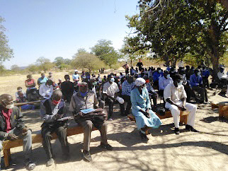
This picture was taken in Aug/Sept this year. Dinde Villagers in a meeting protesting against drilling in their community. The court case which had not been heard yet by the courts is against this same Chinese company, Beifer.
(Photo: Supplied)


The community argues that mining will pollute the Nyantuwe River which is the only source of drinking water for people and livestock in the area. Villagers also fear that, should the project continue, they will be subjected to forced relocations while others will be exposed to air and water pollution of their river as well as destruction of cultural heritage sites.

Mnangagwa supporters say it’s difficult to blame issues of environmental damage squarely on the Chinese because even the established firms like Hwange Colliery are accused of environmental damage. It’s the nature of coal, they point out.

In Zimbabwe, the energy sector is the third biggest driver of greenhouse emissions after agriculture and forestry, but the country’s plans to burn coal for thermal power generation will make the sector surpass the others in the next few years, environmentalists have warned.

The rest of the world is trying to move from coal as part of a global target to end greenhouse gas emissions by the year 2050.

Analysts say Zimbabwe’s government has so far failed to monitor the Chinese firms and to ensure they are strictly following environmental guidelines fearing it would upset Beijing. China is the only country that has continued to fund infrastructure projects since Western donors and multilateral lenders stopped lending to Zimbabwe over arrears more than two decades ago.

Chinese companies have provided funding for roads, power generation, telecoms and upgrades of airports. Zimbabwe owes at least $1,6-billion (R24,5bn) to China, according to latest treasury figures.

Afrochine already runs the biggest high-carbon ferrochrome furnaces in Selous, west of Harare. The company also completed construction of a 150,000 metric tonne coke battery in Hwange in April and has started building another 300,000 tonne per year coking plant, the largest and most advanced coke oven in Zimbabwe.

Names of mines operating in the area are: Chilota South Mining, ZZCC, ZZEE, Dinson, Zambezi Gas, Makomo, Hwange Coal Gasification, Zimzhongzhin, Western Coal, Tsingshan Holding Group, Liberation Mining, JinAn/Tutu Coking, Chaba mine.

Image
Dinson Colliery (Photo: Supplied)

All are Chinese except for Western Coal, Zambezi Gas and Makomo.

Zimbabwe Zhongxin Coking Company is building a 320 megawatt coal-fired electricity generating plant in three phases. The first 50 megawatt has been completed and will be commissioned in 2022. When completed, the power plant is expected to consume 300,000 tonnes of coal annually.

Western Coal is owned by Manangagwa’s close ally Billy Rautenbach. The mine has been accused of mining near the Bumbusi Heritage site inside the Hwange Park.

Afrochine’s Dinson has finished exploration in the park and has not started mining but it has been given another grant on the edge of the park, where it is exploring.

Some of the projects were started last year but some are still at the exploration stage.
Afrochine’s 150,000 tonne coke over battery was completed in July while the 300,000 tonne one is in planning stages. Construction of a 100MW power station has not started.

Zimbabwe Zhongxin Coking Company has completed 50 MW of its 320 MW and is yet to start coal mining as it is at the exploration stage. Beifer investments is also exploring for coal.

Environmentalists say Zimbabwe has two main options to move away from coal. The country receives a lot of sunlight which makes a good case for solar power.

Hwange and its surrounding districts, for example, are among the hottest places in Zimbabwe throughout the year, with an average 8,3 solar hours per day, according to studies.

Hydro-electric power is also an option. A long planned joint project with Zambia is still being tied up by bureaucracy. But there are also mini hydros that are being built, in eastern Zimbabwe, which light up local communities and are easier to maintain.

The biggest challenge for Zimbabwe is funding, which is making a wholesale transition to renewable energy a painfully slow process. Zimbabwe did not receive any funding commitments for renewable energy projects from the West at COP26. DM


"Education is the most powerful weapon which you can use to change the world." Nelson Mandela
The desire for equality must never exceed the demands of knowledge
User avatar
Lisbeth
Site Admin
Posts: 66797
Joined: Sat May 19, 2012 12:31 pm
Country: Switzerland
Location: Lugano
Contact:

Re: Mining in or Close to Protected Areas

Post by Lisbeth »

Olifants River set to become a new home of mining — to the detriment of residents and the environment as a whole

Image
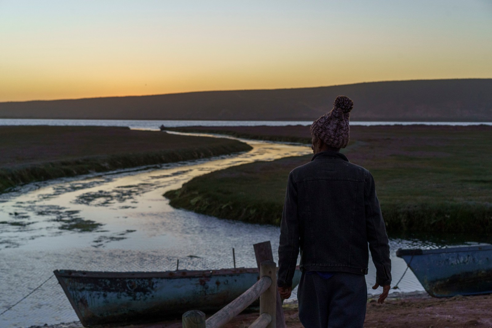
18 November 2021: Andre Cloete, a fisherman born in Papendorp, walks towards the Olifants River. (Photo: Barry Christianson)

By Barry Christianson | 27 Dec 2021

The government granting prospecting rights around the river mouth, which is being declared a community-based marine protected area, threatens food security and livelihoods.

The Olifants River mouth enters the Atlantic Ocean roughly 250km north of Cape Town, as the crow flies. At the mouth, the emerald waters are flanked by the cliffs of De Punt farm on the northern bank, while on the southern bank is the largest floodplain salt marsh in South Africa. The estuary is ranked third in the country in terms of conservation importance and is a critical source of food and livelihoods for many living in Papendorp and Ebenhaeser, two communities on the southern banks of the river.

On the morning of 21 November, the river was quiet. It was a Sunday and the fishers who had worked the night before had gone home with their catches. Cormorants were the only fishers that morning, swimming close to the river mouth and periodically catching fish.

“[The river is about] more than fishing,” said Rhiaan Coetzee, a fisherman who was born in Ebenhaeser. “It’s quiet. I can go there when I am stressed. You only hear the birds and the water. Even if there are no fish, there is that relationship with God and nature.”

Coetzee’s relationship with the river goes back to when he was a child. “When I was eight years old, I used to play at the river, then when I was 10, my father let me go with him on the boat. When I was 12, I had to start rowing.” Coetzee is now 32 and has been fishing on the river for 20 years.

18 November 2021: Rhiaan Coetzee addresses the fishers at a meeting held at Antie Saartjie’s home in Ebenhaeser. (Photo: Barry Christianson)
But that morning, the peaceful feelings associated with the river were tainted with anxiety.

The Department of Mineral Resources and Energy has granted Australian mining company Mineral Sands Resources the right to prospect for heavy minerals on the northern bank of the river. And Minister of Forestry, Fisheries and the Environment Barbara Creecy has dismissed appeals to stop the prospecting.

Creecy’s “recent decision to allow prospecting on coastal land on the northern banks of the Olifants estuary is difficult to understand”, says Merle Sowman, a professor in the environment and geographical studies department at the University of Cape Town (UCT). The prospecting is to take place on the farm remainder of Point #267 and Lot 615 Olifants River Settlement. “This is one of the most undeveloped estuaries in South Africa and has been identified as important for conservation.”

Sowman says the small-scale fishers who live along the river may find their source of food and livelihoods threatened.

From agriculture to fishing

The fishers of the Olifants River are descendants of the indigenous people who settled in the area now known as Lutzville in the 17th century. They were dispossessed of their land in 1925 and moved to Papendorp at the river mouth and Ebenhaeser about 15km upstream.

Their forebears made a living through cattle, agriculture and fishing. But the poor quality of the land near the river mouth to which they were relocated forced them to switch primarily to fishing.

Saartjie Afrika, known to all as Antie Saartjie, is 81 years old and has lived in Ebenhaeser all her life. Her grandparents were among those dispossessed of their land and by the time she was a young girl in the 1940s, her father had already switched to fishing.

Image
18 November 2021: Evening falls in Papendorp with the Olifants River mouth in the background. (Photo: Barry Christianson)

“I can tell you that I was raised from the river water. I got married in Ebenhaeser. When I had children, my husband was also a fisherman. My children were educated through the living we made from the river,” she said.

The fishers catch predominantly harder, also known as mullet. Coetzee calls it the staple food of the Olifants River fishing communities.

When plentiful, fishers sell their catches in the surrounding villages and even as far as Lambert’s Bay, 50km away. When the fish are scarce, fishers often still catch enough to cook for their families.

For the impoverished in these communities, being able to fish on the river is critical to their food security. Harder are caught in rowboats using gill nets. The river fishers don’t have to spend money on petrol or bait. “You need to know the weather, the wind and the tide. If you have that knowledge, you can take your boat on to the river and you’ll know where to drop your net to get some fish,” said Antie Saartjie.

Protected by the community

The fishers understand the value of the river in their lives and want it protected. However, they objected to the first plan to make it a marine protected area as it did not take them into account — the plan attempted to restrict fishing in the first 16km of the river.

Coetzee, who was very young at the time, speaks of that attempt as “the first time they tried to close the river”. He can remember his father sitting him down and telling him that when he grew up, he would have to protect the river as outsiders would try and get rid of the fishers.

“I feel strongly that the river needs to be protected,” echoed Antie Saartjie, “but at the same time there needs to be access for our people to work for a living. [Our people] must protect it. There must be laws that prevent people from coming and damaging it.”

Assisted by the Legal Resources Centre and researchers from UCT, they put forward a proposal for a community-managed marine protected area, which was adopted by all stakeholders. While it is taking longer than the communities had hoped, plans driven by governmental organisation Cape Nature are underway to declare the mouth of the river a marine protected area that will be co-managed by the fishing communities and the Ebenhaeser Communal Property Association, which oversees the newly restituted land.

Papendorp resident Aletta Goliath said they have an influx of holidaymakers to the river mouth every year. “We won’t be able to keep them away because it’s tradition.” This tradition started during apartheid, when the Olifants River mouth and the beach south of it were among the few places non-whites could go.

But “when the marine protected area gets finalised, there will be oversight and we will be able to regulate” activities on the river, said Goliath. Residents are anxious for this to happen as harder are sensitive to these disturbances during the festive season, from the crowds and the motorised boats piloted by visitors to the farms on the northern bank. Goliath said there is a stark drop in their catches at this time.

Knowing this, the fishing communities are concerned that the machinery used to prospect on the northern banks may deter the harder from entering the river mouth, jeopardising their livelihoods and threatening their food security.

Creecy’s decision to allow prospecting doesn’t acknowledge the process underway to have the river mouth area declared a community-managed marine protected area.

Image
19 November 2021: “When the Marine Protected Area is finalised, there will be oversight and we will be able to regulate [activities on the river],” says Aletta Goliath. (Photo: Barry Christianson)

The bigger picture

“A major problem with the current decision-making is that the cumulative impacts of all these prospecting and mining activities are not assessed,” says Sowman. Prospecting applications are submitted and assessed on an ad-hoc basis and while the impact of one particular operation may be minimal, combined with other prospecting and mining activities in and around the area it may be significant.

In addition to Mineral Sands Resources’ prospecting activities on the northern bank, there are applications for prospecting on the newly restituted southern banks. And the mineral resources department has authorised offshore prospecting in five concessions, one of which is in front of the Olifants River mouth.

Sowman says there is a need for a coastal plan that “identifies environmental attributes and sensitive areas that need to be protected, and areas where mining could be feasible”. Such a plan would protect areas like the Olifants River from mining because of their conservation importance. But because there isn’t one, companies have been applying for mining and prospecting rights all along the West Coast, from Elands Bay into the Northern Cape province.

Image
21 November 2021: The Olifants River seen from the Point Farm. (Photo: Barry Christianson)

“If you allow prospecting and it yields positive results, the next step is to apply for a mining right. The issue here is that by allowing prospecting, the government is giving a signal to the applicant that there is in-principle support for mining in that area.”

Should mining go ahead, “it could lead to irreversible environmental damage to important resources” such as critical biodiversity areas, marine habitats and resources, heritage, agricultural lands and palaeontological resources, she says.

Another concern is that mining operations lead to a build-up of sand in the river mouth, as the communities suspect has happened on beaches north of the mouth. Goliath said they are also worried about their air quality should mining go ahead on the northern bank, as a predominant northwesterly wind blows across the river to Papendorp and Ebenhaeser. And that the restriction of access to land where mining operations are underway will interfere with how the communities are able to use their newly restituted land.

Sowman says it could “foreclose future options for longer-term sustainable livelihoods and jobs for the people of this area”.

Endangered culture

That morning, at 6am, before heading out to the river, Coetzee visited his neighbour, Chris Don. Don had just returned from fishing on the river the night before. He had caught about 200 harder. An atmosphere of excitement hung in the air. Coetzee said there had not been fish for a few days, but that the wind had turned from northwesterly to southwesterly and they expected to see harder in the river soon.

Image
21 November 2021: From left: Rhiaan Coetzee and Wilbur Cloete drink tea, as Chris Don sees to the fish he caught the night before. (Photo: Barry Christianson)

In Don’s yard, the fish were laid out on mesh bags while two men manned a fire, braaing them. Cats sat nearby waiting for scraps or small fish to be tossed their way. Don was busy in his shed, salting fish with the salt he had collected from one of the pans next to the river. Later, he would hang them in the sun to make salted and dried bokkom.

On the way from Don’s home to Papendorp, Coetzee let people know that Don had caught harder the night before. Some bought fish because they enjoy them, others because at R1 or R2 each it is their most affordable source of protein. DM

Image
21 November 2021: “My father said, the day we lose this river is the day we will be hungry,” said Wilbur Cloete who lives in Ebenhaeser. (Photo: Barry Christianson)


"Education is the most powerful weapon which you can use to change the world." Nelson Mandela
The desire for equality must never exceed the demands of knowledge
User avatar
Lisbeth
Site Admin
Posts: 66797
Joined: Sat May 19, 2012 12:31 pm
Country: Switzerland
Location: Lugano
Contact:

Re: Mining in or Close to Protected Areas

Post by Lisbeth »

River turns black after coal mine dam collapse next to rural communities and Hluhluwe-iMfolozi game reserve

Image
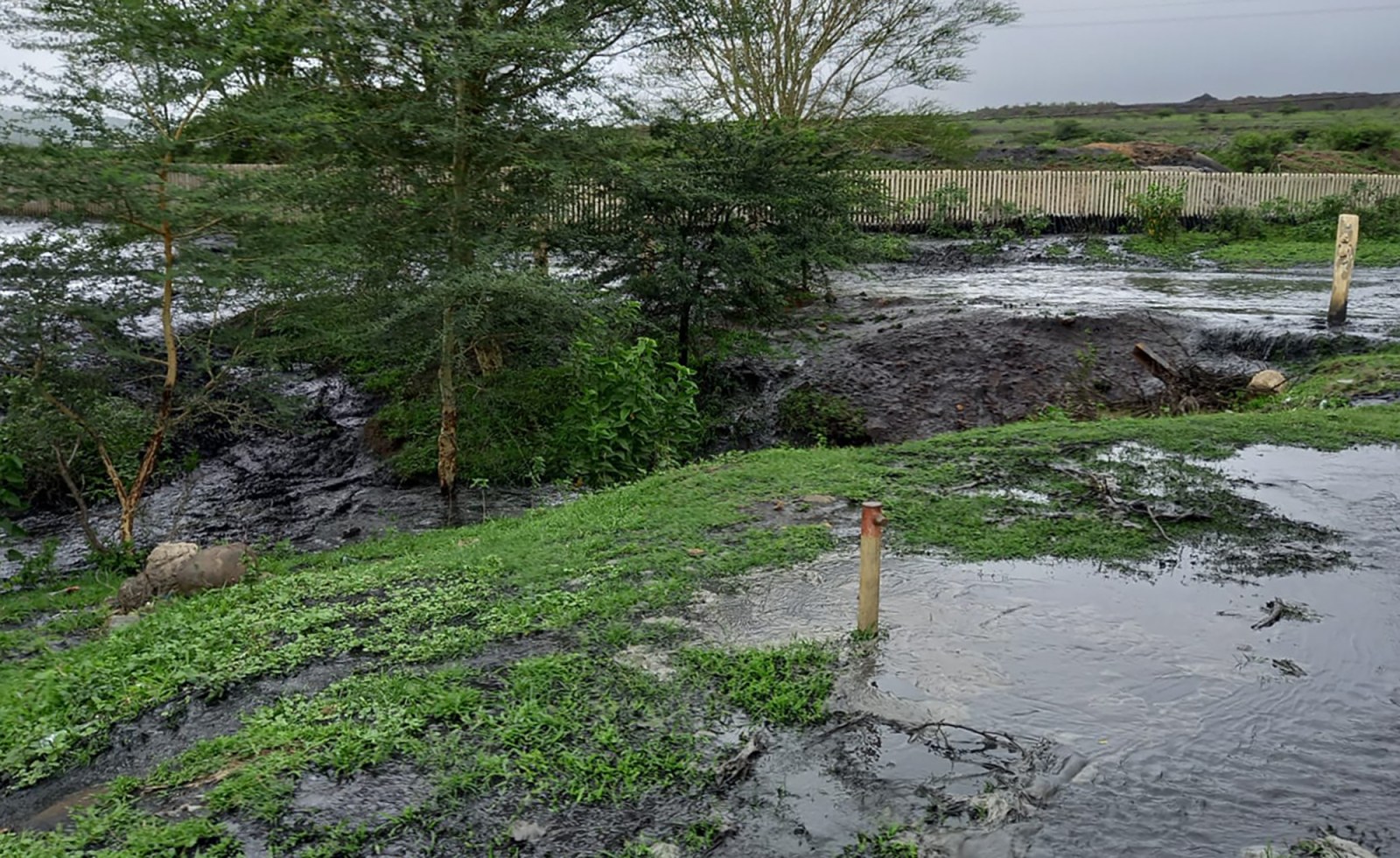
Acidic and potentially toxic coal mining waste pours from the collapsed Zululand Anthracite Colliery slurry dam on 24 December 2021. (Photo: Supplied)

By Tony Carnie | 11 Jan 2022

Large volumes of potentially toxic and acidic coal-mine effluent have spilled into rivers flowing through rural communities and the Hluhluwe-iMfolozi and iSimangaliso wildlife reserves.
.............................................................................................................................................................................
The Zululand Anthracite Colliery (ZAC), a major coal mine in KwaZulu-Natal, is under fire after at least 1,500,000 litres of polluted mine waste burst from a slurry dam and spread into the surrounding land and rivers.

According to the US-based Union of Concerned Scientists, mining and coal-washing operations produce highly acidic water pollution which can also contain toxic heavy metals such as arsenic, copper, lead and manganese.

( I cannot upload the video)
Coal mining effluent pours out of a collapsed slurry dam at the Zululand Anthracite Colliery near Ulundi on 24 December, next to homes, before emptying into the Black Umfolozi River which flows through subsistence farming areas and the Hluhluwe-iMfolozi Park. (Video clip: Supplied)

Though the dam collapse happened on 24 December, residents say some affected communities were not warned about the potential hazards until two weeks later. Conservation managers in the neighbouring Hluhluwe-iMfolozi Park (HiP) were also led to believe that the spill was under control, only to discover a pitch-black plume of water flowing through the park several days later.

Now the mine’s owners have been ordered to expand the ground and surface water pollution monitoring points as far south as the Lake St Lucia estuary, where the Umfolozi River enters the sea.

According to the mine, a three million-litre dam collapsed on December 24, releasing an estimated 1.5 million litres of liquid coal slurry. Mine managers acknowledged that a newly installed slurry pond “end wall” had collapsed. Some of the pond waste had been emptied in November, ZAC said, also suggesting that the wall collapse was aggravated by heavy summer rains in the days leading up to Christmas.

Since then, large volumes of liquid coal mining waste have flowed into the nearby Umvalo River, which in turn feeds the Black Umfolozi River and the White Umfolozi River, which then drains into the sea and the Lake St Lucia estuary mouth.

So far there have been no confirmed reports of human, domestic livestock, fish or wild animal deaths further downstream, but aerial images taken last week show extensive pollution of the Black Umfolozi River inside the wilderness zone of the 96,000ha Hluhluwe-iMfolozi Park. The park is one of the oldest game reserves in South Africa and is home to a significant population of black rhino and white rhino and other protected species.

Image
Several days after the ZAC coal slurry mine collapse, cattle wade through the Black iMfolozi close to Hluhluwe-iMfolozi Park. (Photo: Supplied)

Some residents fear the pollution has contaminated rivers, pans or groundwater used by isolated rural communities in the vicinity of the ZAC mine, located 25km from Nongoma and 40km from Ulundi.

In a letter to the Department of Mineral Resources and Energy, and the SA Human Rights Commission, Okhukho resident Msizi Myaka called for a full investigation into why the slurry dam collapsed and whether a ZAC wash plant and slurry ponds were authorised in terms of environmental legislation.

Myaka said that many residents, including the Jahidada community, depend on the Umvalo and Black Umfolozi rivers for human and livestock drinking water.

“The incident happened on 24 December 2021, at around 2pm, and on 6 January (12 days down the line), ZAC had not communicated this incident with the affected homesteads and Jahidada community as per the requirement of good/best practice and legislation,” Myaka said.

Jahidada residents were not forewarned by the ZAC to take reasonable precautions, nor given Material Safety Data Sheets about the chemicals or metals released from the slurry dam, he said.

In a separate letter to the mine on 6 January, Jahidada community member Gaya Mchunu complained that: “As you know very well, we have only one drinking source — Umfolozi River. This water was polluted by ZAC, and Jahidada residents continued drinking from this source until now. We therefore feel that this was unethical and it compromised our health.”

Image
A view of the patched-up slurry dam. (Photo: D Gold)

He also requested a meeting with mine managers to discuss remediation measures, the provision of clean water to the Jahidada community and livestock and health checks for those who had drunk contaminated water.

The Menar group, which owns the mine, said it was not able to respond immediately to a list of questions sent by Our Burning Planet just after 2pm on Tuesday.

However, in a media statement on 6 January, mine officials said the ZAC was engaging with local community forums and structures to assess “possible damage caused to surrounding host communities” and to discuss a resolution.

“On the 5th and 6th January 2022, ZAC management held meetings with the ZAC Community Forum structures through which the mine regularly interacts with host communities,” the statement noted.

The ZAC suggested that community leaders were “generally satisfied” with the manner in which the ZAC had handled the incident and it was working with relevant authorities “to ensure continued support for livelihoods and economic activities”.

In October 2000, a coal slurry dam in Kentucky, US, collapsed, contaminating hundreds of kilometres of rivers and streams with more than 1.3 billion litres of black sludge. Senior officials of the US Geological Survey said this slurry leak caused fish kills along 93km of the Sandy River and its tributaries and caused widespread disruption to local water supplies in downstream cities.

US Geological Survey chief scientist Dr Geoff Plumlee noted at the time that relatively little information was available about the composition and environmental impacts of coal slurry. However, studies of groundwater quality near other slurry dams showed elevated levels of sulphates, sodium, ammonium, iron, manganese, arsenic, chromium, zinc and cadmium.

While some fish kills could be attributed to the immediate gill-clogging effects of the slurry solids, the long-term chemical and acidic impacts were less clear.

Image
Stained by coal slurry, the colour of the Black iMfolozi River contrasts starkly with the White iMfolozi River at the confluence o the two rivers. (Photo: D Gold)

Ezemvelo KZN Wildlife told Our Burning Planet that the ZAC informed conservation managers on Christmas Day that one of their slurry dams had burst and a significant amount of the coal slurry had been released into the Mvalo stream — which flows into the Black Umfolozi River.

“ZAC also informed Ezemvelo that the slurry had not polluted the Black Umfolozi River in that the slurry had only moved some 3km down the Mvalo stream and that they had already started cleaning up the spill.

“Despite the claims made by ZAC, park staff and tourists reported an accumulation of what appeared to be coal sediment on the edges of the Black Umfolozi River and its sandbanks. With this information, Ezemvelo alerted the Honourable MEC Ravi Pillay and senior members of his department of the risks the ZAC slurry spill posed to the Hluhluwe-iMfolozi Park, the affected communities, downstream users of the Umfolozi River, and the estuary and lake within the iSimangaliso Wetland Park World Heritage Site.

“During this time, staff collected water samples for analysis. On January 5, park staff reported the presence of a large black plume entering the Black Umfolozi River from the Mvalo stream and was about to enter the Hluhluwe-iMfolozi Park.

“A voice note from one of the park rangers described the river as ‘pitch black, black, black’. Ezemvelo immediately appointed hydrological specialists with expertise in mining and mining operations who undertook a site inspection and collected water samples.”

By this stage, the black plume had reached the confluence of the Black and White Umfolozi rivers. At this point, by comparing the colour of the two rivers, one could gain an appreciation of the magnitude of the pollution event, as the Black Umfolozi River was black in colour and had zero visibility for aquatic life. At the same time, the White Umfolozi River was its traditional light sandy-brown colour with moderate (normal) visibility.

“On the afternoon of the 7th, the black plume was seen to be leaving the Hluhluwe-iMfolozi Park. The Umfolozi River flows from the park through the Mpukunyoni traditional community to Mtubatuba town and thereafter flows into the iSimangaliso Wetland Park World Heritage Site.

“Ezemvelo is, at this stage, uncertain of the extent of the damage to the Umfolozi rivers and awaits the report from the hydrological specialists and the analysis of the samples taken. On receipt of this information, Ezemvelo will determine the way forward, including what remedial action needs to be taken. Ezemvelo KZN Wildlife will monitor the rivers and extend this to monitoring and sampling the groundwater to determine whether this critical resource has been contaminated.

“In the meantime, as a precautionary measure, Ezemvelo has put up signage not to drink tap water in the Mpila Camp. Bottled water is available for tourists.”

Ravi Pillay, the KwaZulu-Natal MEC for Environmental Affairs, said he had instructed his department to set up a Joint Operations Committee to investigate the matter and also told the ZAC to expand its water monitoring sampling points as far south as the iSimangaliso Wetland Park.

Pillay had also briefed the national ministers of Forestry, Fisheries and the Environment (Barbara Creecy), Water and Sanitation (Senzo Mchunu), Mineral Resources and Energy (Gwede Mantashe) and the mayors of the Zululand and Ulundi municipalities.

“The department officials have been on site to observe the clean-up processes and establish more facts about the extent of the spill and the potential threat to the public health and the environment.

“We note that ZAC mine has reported that no claims of damages, death or loss of livestock have been reported to them following the incident. While appreciating that report, we will, however, follow our own procedures and investigations,” Pillay said.

The anthracite mine has operated for more than 30 years and has been involved in several controversies during this time involving water pollution, illegal mine expansion and water shortages in neighbouring rural communities.

In 2014, the mine was issued with a “slap on the wrist” R497,000 fine by the KZN Department of Environmental Affairs for establishing three new coal mining shafts without seeking environmental authorisation.

It has also been embroiled in disputes over water pollution and drawing large volumes of water for mining and coal-washing operations, to the detriment of local communities, tourism and wildlife in the HiP.

Originally owned by BHP Billiton, the mine was later operated by Riversdale Mining and Rio Tinto before it was acquired in 2016 by the Menar group, founded by Turkish-born entrepreneur Vuslat Bayoğlu.

Menar has interests in gold and nickel in Turkey and Kyrgyz Republic, along with several coal and manganese mining operations in South Africa.

More recently, Bayoğlu’s group has been pushing to establish a new coal mine on the southern boundary of the Hluhluwe-iMfolozi Park, Africa’s oldest wilderness area. DM/OBP


"Education is the most powerful weapon which you can use to change the world." Nelson Mandela
The desire for equality must never exceed the demands of knowledge
Post Reply

Return to “Mining and Other Extraction Issues”